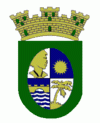
Orocovis (Orocovis Municipio)
 |
 |
Since before the Spanish colonization in the 16th century, the Taíno were already established in the region. They were led by the cacique Orocobix and his tribe known as the Jatibonicu. After Spaniards settled in the island, the region was part of the south of Manatí and the north region of Coamo. By 1823 Orocovis was a barrio of Barranquitas while Morovis (previously part of Manatí) had a barrio called Barros. Both Orocovis and Barros were eventually united to establish a new town.
On May 25, 1825, the neighbors of the region granted don Juan de Rivera y Santiago the power to request the Governor authorization to found a municipality in the Barros area, where they had bought 14 acres of land from doña Eulalia (Olaya) de Rivera Melendez, who donated an additional acre to establish several municipal works. However, due to the distance from bodies of water, the settlement was moved to another place where it is today. On November 10, 1825, Governor Miguel de la Torre granted permission to found the new municipality of Barros.
In 1838, the parish of San Juan Bautista de Barros was created and was blessed and inaugurated on October 29 of the same year. However, on 1875, a fire destroyed the church, the King's House, the priest's house and several homes.
Most of Orocovis nicknames stem from its location in the center of the island. Some of them are: "Corazón de Puerto Rico" (Heart of Puerto Rico) and "Centro Geográfico de Puerto Rico" (Geographical Center of Puerto Rico). Locals say the center of Puerto Rico is in a barrio called Pellejas, on Road 566, Km 5.7 in Orocovis. That the center of Puerto Rico is in front of the Catholic church was determined to be false by engineers from the University of Puerto Rico, Mayagüez Campus.
Puerto Rico was ceded by Spain in the aftermath of the Spanish–American War under the terms of the Treaty of Paris of 1898 and became a territory of the United States. In 1899, the United States Department of War conducted a census of Puerto Rico finding that the population of Barros, as Orocovis was then called, was 14,845.
In 1928, the Legislative Assembly of Puerto Rico approved a resolution to change the name of Barros to Orocovis, to honor the Taíno cacique of the same name, who lived in that region.
Map - Orocovis (Orocovis Municipio)
Map
Country - Puerto Rico
 |
 |
Currency / Language
| ISO | Currency | Symbol | Significant figures |
|---|---|---|---|
| USD | United States dollar | $ | 2 |
| ISO | Language |
|---|---|
| EN | English language |
| ES | Spanish language |


